French Rivers You’ll Want to See Across France
Follow french rivers from mountain valleys to busy towns, with a friendly guide to the waterways, regions, and places you can visit across France.
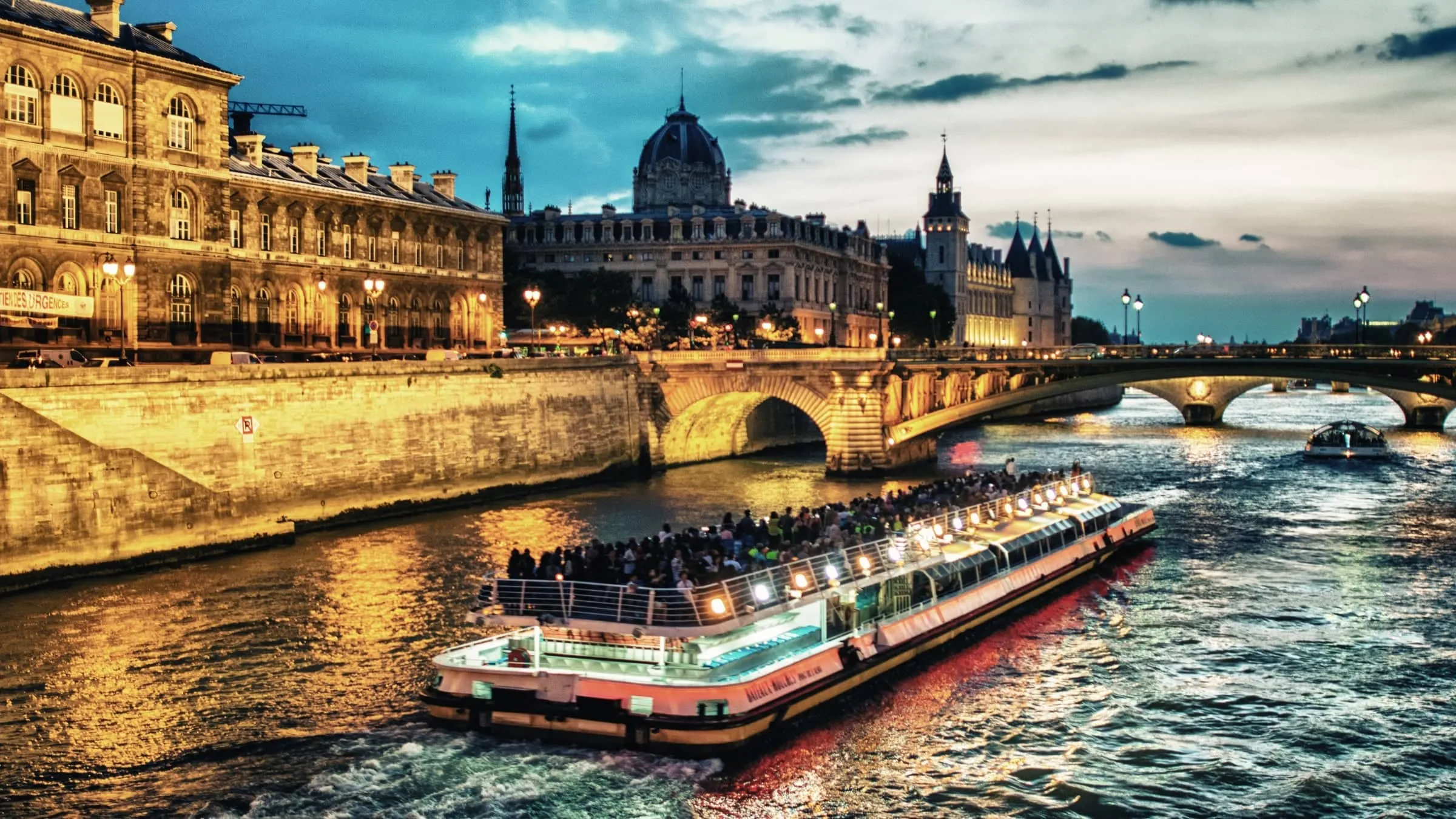
French rivers flow from mountain ranges across France to the Atlantic, English Channel and Mediterranean. They shape famous cities and wine regions, carry water through farmland and once offered cheap transport before railways arrived. Follow them on a map, and you'll see the country’s geography come alive.
Rivers of France from Mountains to Sea
Mountains and Watersheds
Picture France as a broad bowl tilted toward its northern and western coasts. The Alps, Jura and Vosges rise along the east, while the Pyrenees form a southern wall beside Spain. In the south central highlands, the Massif Central sends water in several directions.
These uplands create watersheds, with ridges deciding which way rain and melting snow will travel. Streams gather into tributaries, tributaries feed larger rivers, and the growing channels wind down toward plains and coastal estuaries.
Three Coastal Destinations
Most rivers of France head north or west. The Loire rises in the Massif Central and reaches the Atlantic near Saint Nazaire, while the Garonne gathers water from the Pyrenees before joining the Dordogne in the Gironde estuary. Brittany’s shorter rivers also run directly toward the Atlantic.
Northern waterways take another route. The Seine begins near Dijon, collects tributaries including the Marne, Oise and Yonne, then enters the English Channel between Honfleur and Le Havre. The Somme reaches the same coast through its wide estuary.
Southeastern France drains toward warmer seas. The Rhône arrives from Switzerland, receives the Saône at Lyon, then runs south to its Mediterranean delta. Farther west, rivers descending from the Pyrenees, including the Aude, also reach the Mediterranean coast.
Following the Loire River Westward
The Eastern Loire Valley
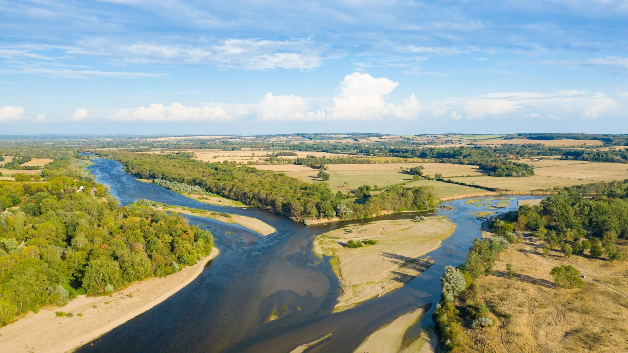
From its high source in the Massif Central, the Loire bends northwest through a quieter, greener part of France. By Nevers, it has become a broad river, often divided by sandbanks and wooded islands.
Farther on, the banks pass the wine country of Pouilly and Sancerre. Vineyards climb nearby slopes, while old towns look across the water from stone bridges and riverside paths. The Loire then reaches Orléans and turns southwest.
Château Country
Beyond Orléans, the river enters the stretch seen in countless travel images. At Blois, the château rises above town, while nearby Chambord brings towers, chimneys and woodland. Amboise offers another memorable riverside stop, along with Clos Lucé, where Leonardo da Vinci spent his final years.
Tours makes a handy base for the region called the Garden of France. From here, you can reach Chenonceau across the Cher and Azay le Rideau beside the Indre. These smaller rivers feed the Loire system and connect some of its best loved estates.
Villandry draws visitors with formal gardens arranged in crisp patterns, while Fontevraud adds a medieval abbey to the route. Wine remains part of the journey, with vines, cellars and tasting rooms spread around villages near the river.
Nantes and the Atlantic
West of Tours, the Loire passes Angers, where the vast Apocalypse hangs inside the château. The river grows wider toward Nantes, a city shaped by shipping, industry and its long connection with Brittany.
Below Nantes, fresh water meets Atlantic tides. Marshes, mudflats and working docks replace château gardens as the estuary opens toward Saint Nazaire. Here, the longest river in France reaches the ocean.
Among France’s major rivers, the Loire offers an unusually varied journey. It links mountain country, vineyards, royal homes and ports without losing the shifting, open character that sets it apart from many of Europe’s longest rivers.
Why the Seine Defines Paris
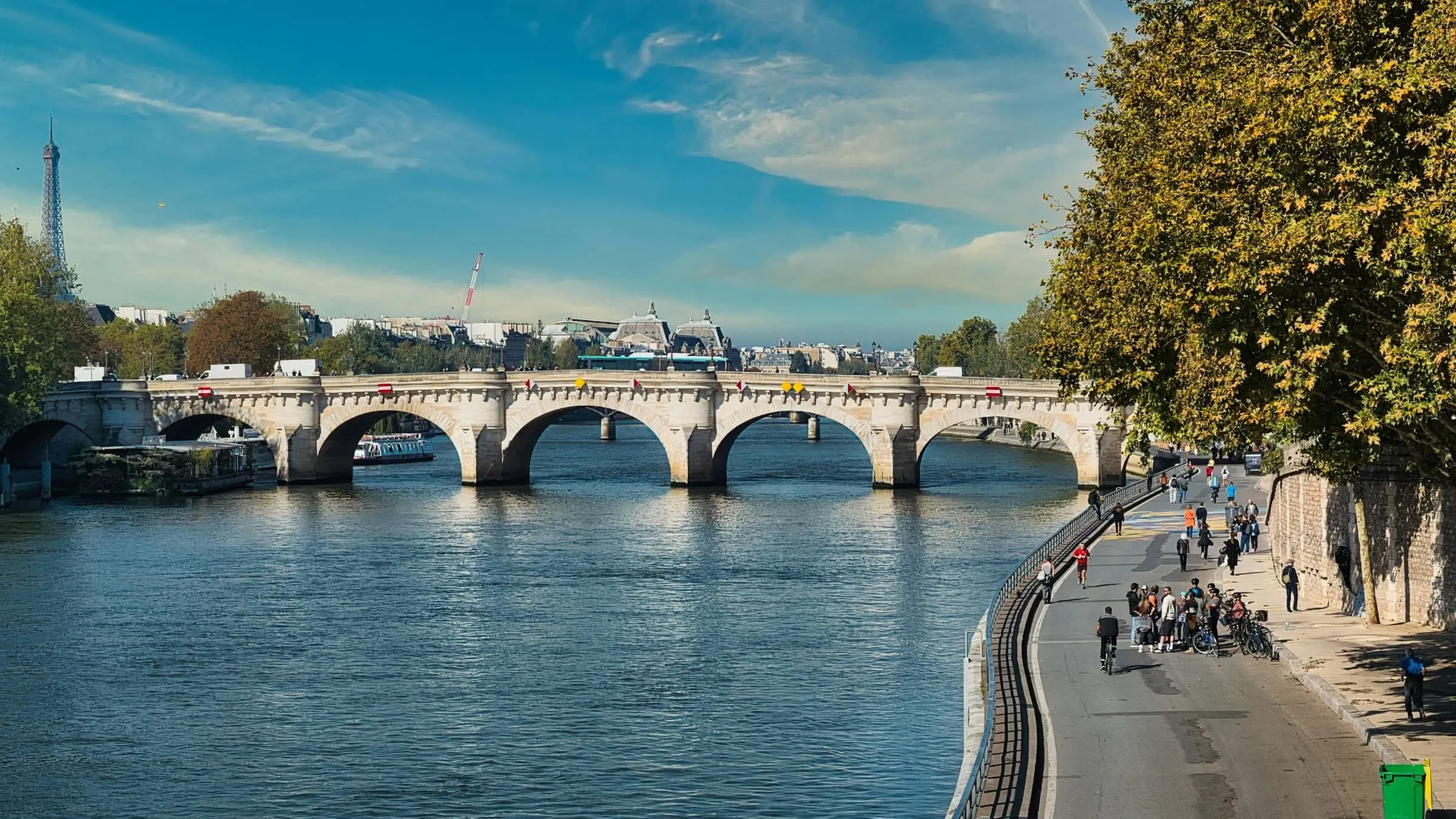
Paris and Its Two Banks
From its source near Dijon, the Seine runs northwest through Troyes, then winds past Fontainebleau Forest, Melun and Corbeil. The Yonne joins upstream of Paris, adding water from Burgundy before the river reaches the capital.
In Paris, the Seine gives the city its familiar shape. It separates the Right Bank from the Left Bank, threads around its islands and places many famous sights within an easy riverside walk. The Marne enters near the city’s eastern edge, while the Oise joins farther downstream.
Normandy to the Channel
Beyond Paris, the river loops across northern France toward Rouen. Here, Gothic towers, quays and old warehouses recall a city long tied to river trade. The Seine also inspired many Impressionist images, as painters returned to its shifting light, mist and reflections.
Below Rouen, the water broadens into an estuary between Normandy’s green banks. Honfleur sits near the southern side of its mouth, with a historic harbour lined by narrow houses. Across the estuary, Le Havre remains a busy port facing the English Channel.
The Rhône Runs Toward the Mediterranean
Lyon and the Saône
The Rhône begins in the Swiss Alps and passes through Lake Geneva before entering France. It bends through the Jura foothills, gathering water from the Ain, then reaches Lyon, where two great river routes meet.
The slower Saône arrives from the north, linking Lyon with Burgundy and its wine country. Their meeting helped make the city a centre for trade, with quays, warehouses and neighbourhoods spreading beside both rivers.
Through the Rhône Valley
South of Lyon, the Rhône follows a broad valley between steep hills and sunny slopes. The Isère joins from the Alps near Valence, bringing mountain water into the main channel. Farther south, the Durance arrives after crossing Provence.
This is one of France’s great vineyard routes. Vines rise above towns such as Vienne, Tournon and Valence, while the river passes wine areas including Côte Rôtie, Hermitage and Châteauneuf du Pape near Avignon. From a train or riverside road, you’ll see terraces, orchards and pale limestone ridges changing with every bend.
Avignon’s walls and broken medieval bridge bring the river’s history close. Arles, farther downstream, grew where river traffic could connect inland farms and towns with Mediterranean trade. Canals also tie the Rhône to Marseille, Sète and smaller ports along the coast.
The Mediterranean Delta
Below Arles, the Rhône divides into the Grand Rhône and Petit Rhône. Between them lies the Camargue, a flat delta of marshes, lagoons, rice fields and grazing land where fresh water meets salt.
The Grand Rhône reaches the sea near Port Saint Louis du Rhône, an industrial and trading port. The Petit Rhône runs toward Saintes Maries de la Mer, where the coast feels quieter and wilder. Here the river finishes its long southern course through reed beds and shifting channels, opening into the Mediterranean.
Two Rivers Meet Near Bordeaux
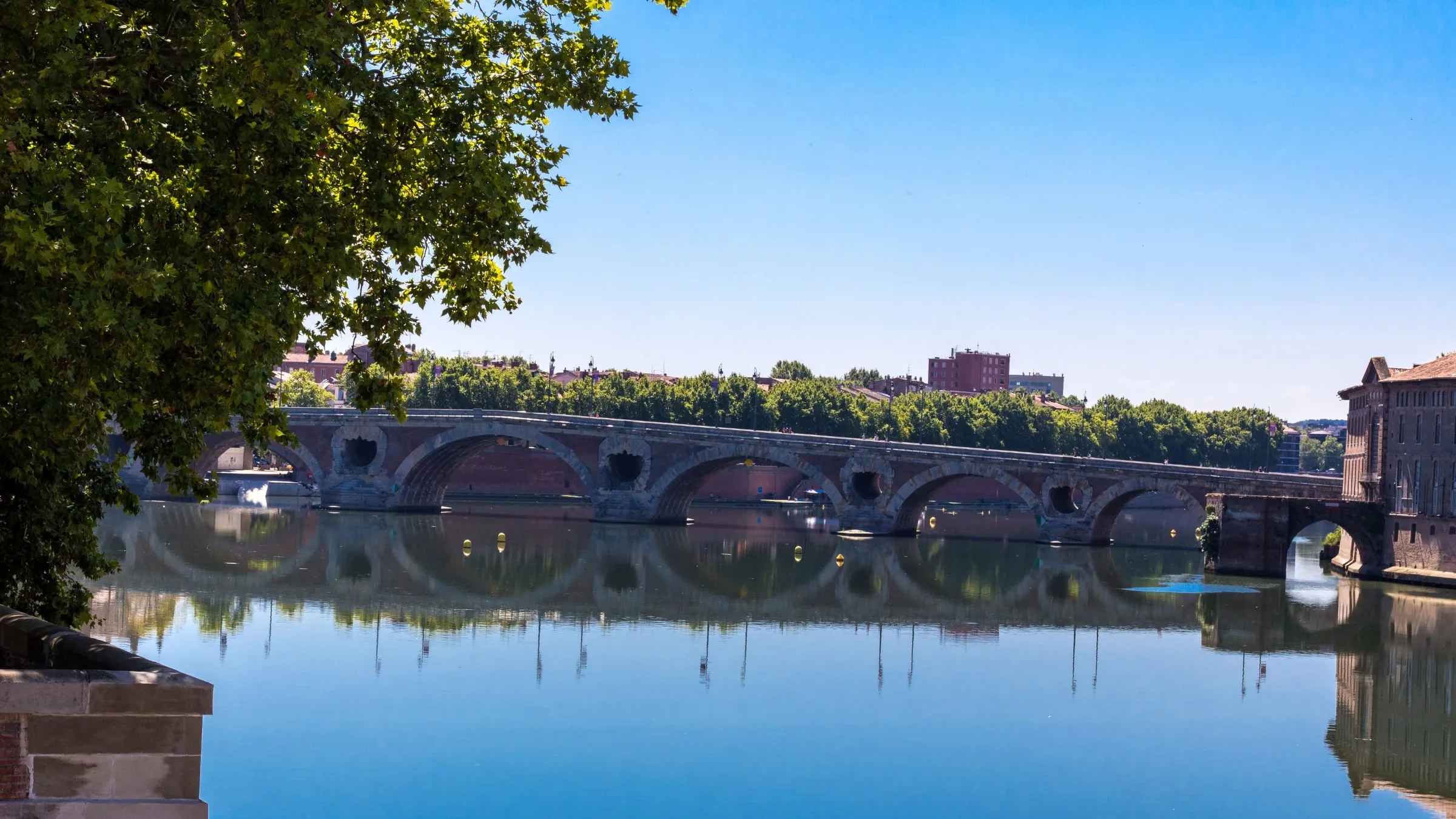
The Garonne Through Toulouse
The Garonne enters France from the Pyrenees, gathering cold mountain streams before crossing the broad plain around Toulouse. In the city, brick quays and bridges frame the water, especially where the Pont Neuf crosses its broad channel.
Below Toulouse, the river turns northwest through farmland and receives the Tarn and Lot. One of the longest rivers in France, it reaches Bordeaux as a tidal waterway, carrying the Atlantic’s rise and fall into the city. Curving quays and former warehouses reveal how deeply river trade shaped Bordeaux.
The Dordogne and Vézère
The Dordogne follows a different course through southern France. It winds through deep gorges around Argentat, then passes wooded slopes, limestone cliffs and villages such as Beaulieu sur Dordogne and La Roque Gageac. Marqueyssac’s gardens provide memorable images of the river curling through the valley below.
Farther west, the Dordogne reaches Bergerac, where old streets and wine country spread from its banks. Here, vineyards, farms and small ports replace the steeper country upstream. Of the two rivers approaching Bordeaux, the Dordogne keeps a quieter, more rural character.
The Vézère joins the Dordogne after crossing a valley rich in prehistoric sites. Caves, rock shelters and ancient settlements preserve traces of people who lived in France thousands of years ago. Its UNESCO listed sites make this tributary an exceptional route into early human life.
The Gironde Estuary
Near Bec d’Ambès, north of Bordeaux, the Garonne and Dordogne meet to form the Gironde. The two rivers create a broad, tidal estuary that opens into the Bay of Biscay.
Vineyards line parts of the banks, while marshes, fishing huts and port towns mark the route toward the ocean. Islands divide the muddy water, and ships follow the deep channel to Bordeaux. Near the mouth, Atlantic beaches replace the sheltered river country, completing one of France’s great waterways.
More Longest Rivers Across the Map
Atlantic Bound Waterways
The Charente runs 381 kilometres across southwest France, starting near Rochechouart in Haute Vienne. It passes through gently rolling country before reaching the Atlantic near Rochefort, where tides influence its broad lower course.
Farther south, the Adour travels 309 kilometres from the central Pyrenees to Bayonne. Mountain streams feed its upper reaches, while its mouth meets the Atlantic close to the city’s port and beaches.
Brittany’s Vilaine is shorter at 225 kilometres. Rising in the Mayenne department, it crosses western France and enters the Atlantic at Pénestin in Morbihan. Its route feels distinctly Breton, passing green farmland and towns before widening near the coast.
The Rhine and Somme
The Rhine dwarfs most rivers on this map, running 1,325 kilometres through Europe. Only 188 kilometres touch France, largely forming its eastern border with Germany before the river continues north toward the North Sea. Around Alsace, its broad channel, islands and wetlands mark a natural frontier.
The Somme stays entirely in northern France and runs for 263 kilometres. It rises at Fonsommes, near Saint Quentin, then flows west through a low, open valley toward Abbeville. Beyond the town, it spreads into an estuary of marshes, tidal flats and bird habitat before reaching the English Channel at Saint Valéry sur Somme.
The Aude in the South
The Aude begins in the Pyrenees and covers 224 kilometres on its way to the Mediterranean. Its upper course cuts through rugged southern country before turning toward the plains around Carcassonne.
There, the river passes below the city’s famous fortified walls, giving you one of France’s most memorable waterside images. It then continues east through vineyard country, passes Narbonne and reaches the Mediterranean coast. Among the longest rivers listed here, the Aude makes the clearest link between high Pyrenean country, medieval towns and the warm southern sea.
How France Puts Waterways to Work
Irrigation and Early Transport
Before railways, rivers gave farms water and offered an affordable way to move bulky loads. Canals, weirs and smaller channels directed water toward fields, orchards and mills, while barges carried grain, timber, wine and stone between inland communities.
That history still shows in towpaths, lock houses and canals beside the main channels. France has 12 river-basin districts and more than 11,000 designated surface-water bodies. Managing them means balancing farming, transport, drinking water and wildlife across a remarkably connected system.
Trade and River Ports
A river town often tells its story through its waterfront. Broad quays gave boats room to unload, warehouses kept goods dry, and bridges concentrated shops and workshops around busy crossing points. Inns, markets and boatyards grew nearby because crews and merchants needed food, repairs and places to bargain.
Larger ports connected inland producers with coastal shipping. Bordeaux sent wine through the Gironde, Rouen linked the Seine with the English Channel, and Lyon handled goods moving along the Rhône and Saône. Even where commercial barges have faded, old cranes, stone steps and converted warehouses reveal how trade once organised everyday life.
Water Power in the Mountains
In the Alps, Jura, Massif Central and Vosges, steep drops give moving water unusual force. Communities used it to turn mill wheels, grind grain, saw timber and power workshops. A dependable stream could shape where people built homes and businesses.
Later, dams and hydroelectric plants turned the same downward rush into electricity. Their reservoirs, pipes and power stations now share narrow valleys with villages, roads and farms. When you travel through Alpine country, watch how settlements gather beside water while engineering works cling to the slopes. The view explains why rivers mattered long before modern power grids, and why they remain part of France’s working life.
How River Lengths Compare
A river’s length looks simple on a map, but the figure depends on where the main channel begins and ends. Measuring winding watercourses can also produce small differences, especially where headwaters split into several streams. Different maps may follow different branches through marshy ground. That’s why published totals don’t always match exactly.
The Rhône offers another wrinkle: a river may cross borders, so its full length and its distance within France are different. It spans 504 miles (813 kilometres), including 338 miles (545 kilometres) in France. On a France map, the shorter figure is often more useful for planning a route.
Among southern waterways, the Garonne runs 357 miles (575 kilometres), while the Dordogne covers 300 miles (483 kilometres). The Saône is close behind at 298 miles (480 kilometres). Those near totals are a useful reminder that rank alone tells you little: bends, valleys and accessible banks shape how long a river journey feels to you.