Deepest River in the World Is the Congo River
Meet the Congo River, the deepest river in the world, and see how scientists measure its great depth beneath its strong, dark, fast-moving current.
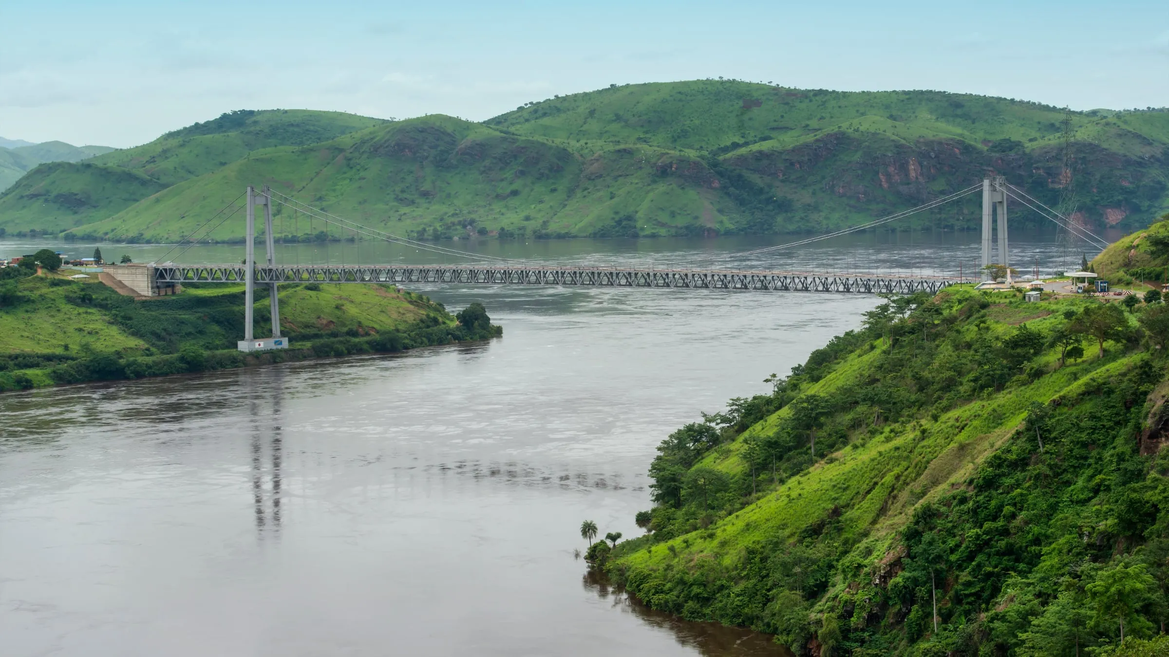
The Congo River is the world’s deepest river, reaching measured depths of about 220 metres. Its underwater canyons and powerful currents create unusual habitats while carrying vast amounts of water through Central Africa and into the Atlantic Ocean.
How the Deepest River in the World Is Measured
World’s Deepest River
At roughly 720 feet, the Congo’s deepest point could swallow a tall city skyscraper below the surface. That figure describes the greatest depth recorded during surveys, rather than the depth along the whole river.
Researchers usually map the riverbed with sonar, sending sound pulses downward and timing the echoes that return. They may also track water speed and direction, which helps them read channels where fierce currents make surveys difficult.
Published figures can differ because teams may examine different spots or use different equipment and reference levels. Some reports also round the same measurement differently, which explains why you’ll sometimes see 720 feet and sometimes 722 feet.
Water levels rise and fall with rainfall, while moving sediment can reshape the bed. The record is best understood as the greatest reliably measured depth, rather than a fixed limit known across every channel.
Where the Congo River Runs
Source and Mouth
Follow the longest headstream, and the journey begins with the Chambeshi River in Zambia. Its water continues through the Luapula River and Lake Mweru, then enters the Luvua and joins the Lualaba in the Democratic Republic of the Congo. The Lualaba is the upper Congo, running north through the country’s interior.
Below Boyoma Falls near Kisangani, the river takes the Congo name. From there, it travels in a broad curve across Central Africa before reaching the Atlantic Ocean near Muanda. Its estuary lies beside Angola’s Cabinda exclave, where the river widens dramatically as fresh water meets the sea.
Route Across Africa
The Congo’s course looks almost like a giant hook on a map. The Lualaba crosses the equator while flowing north, then the main river crosses it again after turning southwest. No other major river crosses the equator twice.
From Kisangani, the middle section flows northwest through rainforest, passing settlements and gathering water from major tributaries. Near Mbandaka, it bends toward the southwest. The Ubangi joins from the north, carrying water from areas near the Central African Republic, while the Kasai arrives from the south after draining parts of Angola and the Democratic Republic of the Congo.
Farther downstream, the river reaches Pool Malebo, a broad expansion shared by two national capitals. Kinshasa, capital of the Democratic Republic of the Congo, faces Brazzaville, capital of the Republic of the Congo, across the water. Few places let you look from one capital directly toward another.
Below the cities, the Lower Congo squeezes into steep channels and races through cataracts toward Matadi and Boma. These rapids divide the navigable stretches, so river traffic can’t follow one continuous route from the interior to the coast. The final section runs west before opening into the Atlantic.
Inside the Vast Congo River Basin
Basin Size
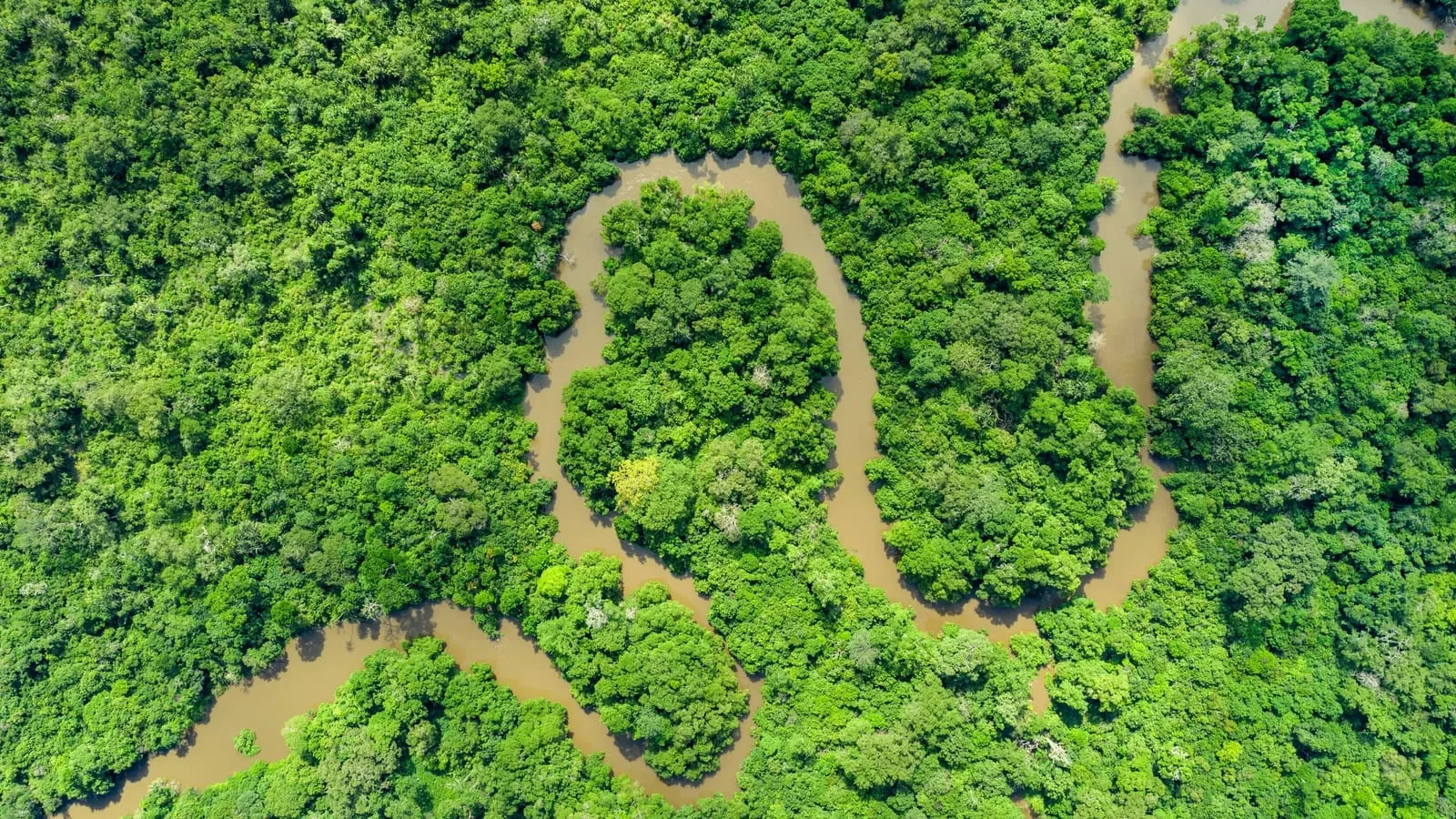
Picture an area nearly as large as the European Union, filled with rivers, wetlands and dense forest. The Congo River basin covers about 4,014,500 square kilometres, or 1,550,000 square miles. That amounts to roughly 13 percent of Africa’s entire land area.
The basin reaches across ten countries in Central, eastern and southern Africa. Most of it lies within the Democratic Republic of the Congo, but its outer watersheds extend into neighbouring states. A raindrop landing far from the main channel may enter a small stream, pass through several tributaries and eventually join the Congo.
This vast drainage network gathers water from rainforest lowlands, broad plateaus, mountain slopes and large lakes. Countless smaller waterways feed major tributaries such as the Ubangi and Kasai. Together, they form Africa’s largest river basin and the world’s second largest, behind only the Amazon River basin.
Rain and Flow
The equator runs through the basin, dividing it between two broad rainy season patterns. When rains ease on one side, wetter weather is often feeding rivers on the other. You can think of it as two huge collection areas taking turns sending water toward the main channel.
North of the equator, tributaries rise and fall with their region’s wet months. Rivers south of the equator follow a different seasonal rhythm. Their flows meet in the Congo, smoothing out the sharp swings that rivers within a single climate zone may experience.
This balance keeps an immense volume of water moving through the system throughout the year. Levels still change with rainfall, and floods spread into forests and wetlands, but the river doesn’t depend on one short wet season. Water arriving from opposite halves of the basin gives the Congo a steadier flow as it moves west.
What Carved the Congo River So Deep
Underwater Canyons
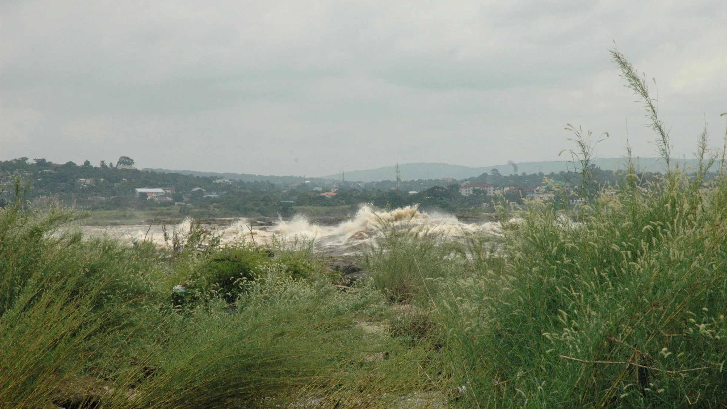
Below Malebo Pool, the broad river suddenly meets a tighter path. Rocky walls squeeze the Congo into narrow channels, forcing an immense flow through much less space. Water speeds up, twists into strong currents and plunges through steep changes in the riverbed.
That force scours sediment and loose rock from the bottom. Swirling water can dig into weak points, while sand and stones carried by the current grind against the bed. Over time, erosion deepens existing channels and cuts canyonlike trenches hidden beneath the surface.
The bottom isn’t shaped like a smooth bowl. It has sharp slopes, deep troughs and sudden rises that steer water in different directions. Currents can descend into these trenches, race along them and rise again, making the Lower Congo difficult to survey and unusually dangerous.
Livingstone Falls
Livingstone Falls is the name for a long chain of cataracts and rapids, rather than one waterfall. Here, the river loses height as it pushes through rocky gorges between Malebo Pool and the lower reaches near Matadi. Each constriction concentrates the current and sends water tumbling over uneven ground.
The Congo River’s Livingstone Falls comprise about 32 cataracts and rapids that drop roughly 270 metres over 350 kilometres, making the lower river unnavigable between Malebo Pool and Matadi. In places, steep banks leave the river little room to spread, so its energy drives downward as well as forward.
The same geology links the rapids above water with the canyons below it. Softer or fractured rock wears away sooner, while harder layers remain as ledges, steps and narrow gates. Those barriers redirect the current into deep chutes and swirling pools, helping preserve the Congo’s deepest known sections.
How the River Giants Compare
Amazon River
The Amazon River reaches a known maximum depth of around 124 metres in Brazil’s lower reaches near Itacoatiara and Óbidos. That places it behind the Congo in depth, yet its other measures reveal a river operating on an even broader scale.
It carries more water than any other river on Earth and releases about one fifth of the freshwater entering the oceans. The Amazon also drains the world’s largest river basin, gathering rain from thousands of tributaries across Peru, Colombia and Brazil.
Its depth changes as seasonal floods lift the surface and spread into forests beside the channel. These shifts help explain why maximum depth is only one way to compare massive rivers. By discharge and basin size, the Amazon leads the world, while the Congo keeps the depth record.
Mekong River
The Mekong River reaches about 100 metres at its deepest known points, especially where it cuts through steep gorges in China and Laos. That’s less than half the Congo’s recorded maximum, though it still places the Mekong among the deepest measured rivers.
Its 4,350 kilometre course begins on the Tibetan Plateau and passes through six countries before reaching the South China Sea. Deep channels appear within a much longer system of gorges, floodplains and delta waterways, each shaped by different currents and seasonal conditions.
Monsoon rains can greatly change the river’s level, so depth varies through the year and from place to place. The Mekong’s place in a depth table says little about its vast fisheries or its importance to communities across mainland Southeast Asia. Those qualities require their own measures.
St. Lawrence
The St. Lawrence connects the Great Lakes with the Atlantic Ocean, creating a major water route between inland North America and the coast. Published maximum depths vary, with figures of 65 metres and 76 metres appearing in river comparisons.
Part of that difference comes from where and how the waterway is measured. The St. Lawrence includes natural channels, widened sections and a managed shipping route. Glaciers helped shape its deep foundation, while later dredging altered parts used by large vessels.
Even at the higher published figure, the St. Lawrence reaches only about one third of the Congo’s measured maximum. Its global importance comes largely from connection and access. Depth allows ocean ships to travel deep into the continent, making the river central to transport despite its lower depth ranking.
Mississippi River
The Mississippi River reaches about 61 metres in the lower part of its course, with its deepest areas occurring after the Ohio River joins it. Picture a tall building placed beneath the surface, and the scale remains impressive, even beside the Congo.
The Mississippi drains a huge watershed across the United States and carries sediment toward the Gulf of Mexico. That moving load continually reshapes the bottom, building bars in some places and scouring deeper channels in others. Its maximum depth can shift as currents and floods rearrange the bed.
Length produces another familiar ranking. The Mississippi system is among the world’s longest, while its measured depth sits well below rivers such as the Congo, Amazon and Mekong. A long course gives the river more room to gather tributaries and sediment, while local geology and current speed determine where its deepest holes develop.
A River Alive Below the Surface
Life in Deep Water
Below the surface, the Congo River holds a maze of habitats. Deep channels stay dark, while shallower edges, rocky bottoms and tributary mouths offer warmer, calmer water. Fish can find food and shelter within each zone, even when another suitable habitat lies surprisingly close.
Life in the Lower Congo faces fierce currents, sudden drops and powerful swirls. Some fish cling to rocks with flattened bodies or specially shaped fins, while others shelter behind ledges where the flow weakens. Deep water adds intense pressure and little light, favouring animals that can sense movement or find food without relying heavily on sight.
Underwater canyons can separate fish much like mountains divide animals on land. A current may prevent small fish from crossing between neighbouring stretches, leaving groups isolated. Over generations, these divided populations can develop different shapes, colours and ways of surviving, which helps explain the river’s unusual variety of fish.
Rainforest Wildlife
The main channel is only part of this living system. Tributaries thread through rainforest, wetlands spread beside slower waters, and seasonal floods carry fish into submerged forest. There, fallen fruit, insects, leaves and other organic matter provide food, while tangled roots create nurseries for young animals.
Different waters support different communities. Clear streams, muddy tributaries, quiet pools and fast channels vary in oxygen, temperature, current and available food. Catfish search the bottom, cichlids occupy many kinds of habitat, and other fish move between channels and flooded areas as water levels change.
The basin also supports crocodiles, turtles and aquatic mammals, along with countless insects and other small creatures. Birds feed along banks and wetlands, while rainforest animals depend on streams for water. These connections carry energy between forest and river: leaves feed aquatic life, fish spread nutrients, and floods link habitats that seem separate during drier months.
How People Have Used the Congo
Names and History
The Congo River takes its modern name from the Kingdom of Kongo, which once held land along its southern bank. The kingdom was named for the Kongo people. Their communities and trade routes grew around the river and nearby coast.
Another old name, Zaire, came through Portuguese from the Kikongo term “nzadi o nzere,” meaning “river swallowing rivers.” European maps and books widely used Zaire in earlier centuries. Congo later became more common in English.
The river carried the Zaire name again when the Democratic Republic of the Congo was called the Republic of Zaire. Today, both countries across the lower river bear the Congo name. Their names keep this long history visible on modern maps.
Trade and Travel
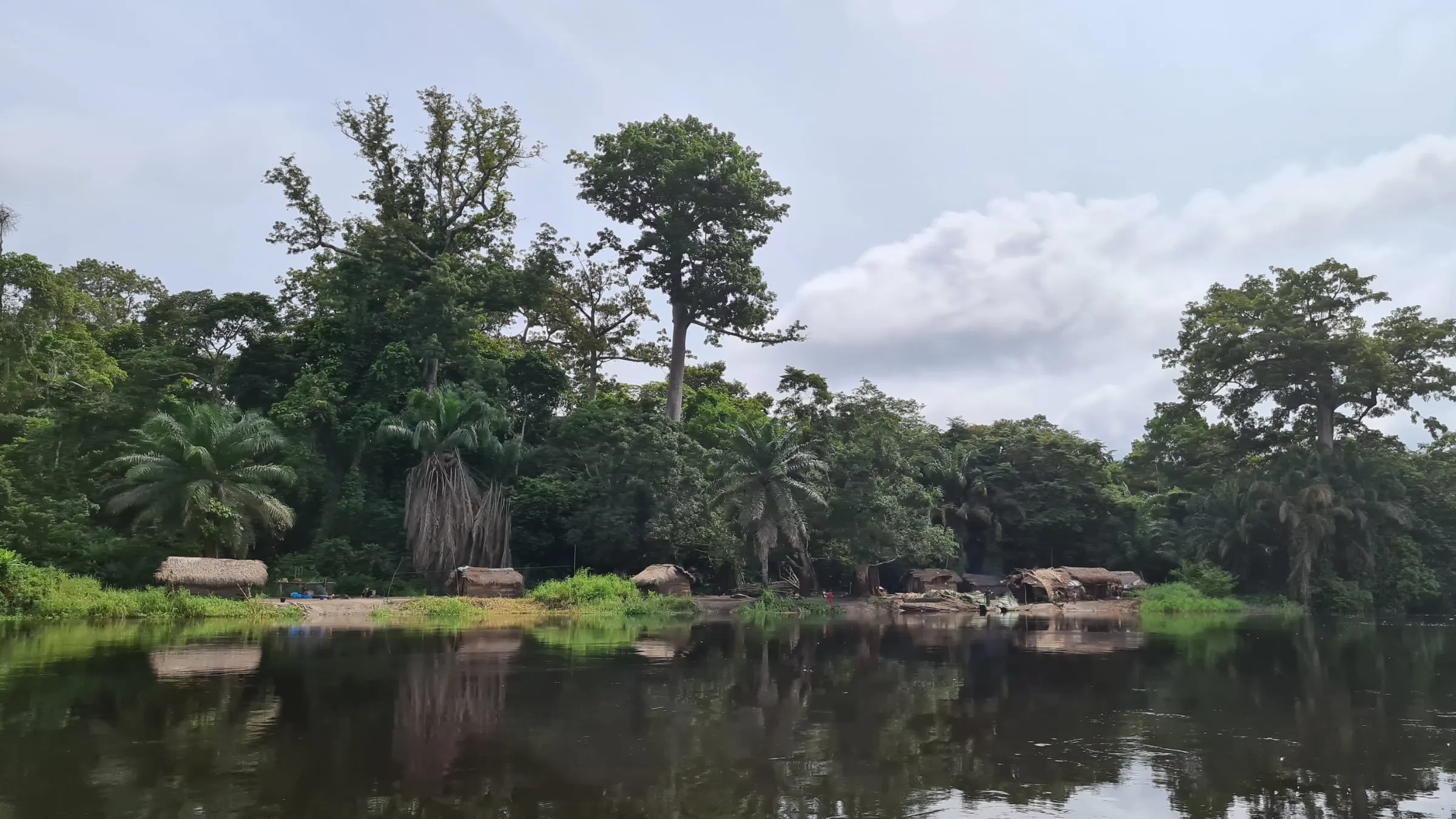
For people beside the Congo and its tributaries, the water is a road, fishing ground and household supply. Fish provide food and income. Boats carry passengers, crops, fuel and other goods between communities that may have few dependable roads.
Long stretches of open water support local and regional trade. Ferries cross Pool Malebo between Kinshasa and Brazzaville. Farther upstream, canoes, passenger vessels and cargo boats travel through the broad central reaches and along major tributaries.
River transport operates as separate networks rather than one continuous shipping lane. Kinshasa became an important transfer point between inland boats and overland connections to Matadi, where seagoing trade reaches the lower river. Cargo may change hands several times during one journey.
River water also supports washing, cooking and drinking supplies, though access to treated water varies greatly. Towns draw water from the Congo and its tributaries. Many smaller communities collect it directly, so poorer water quality can quickly affect daily life.
Hydropower Potential
The same steep descent that challenges river travel gives the Lower Congo enormous hydropower potential. Fast currents and sharp drops pack great energy into the cataracts between Pool Malebo and Matadi. Turbines can turn some of that moving water into electricity.
Projects on the river can supply homes, mines and factories. Plans for more generation have often focused on the lower reaches. Yet electricity needs transmission lines and dependable local networks before it can reach distant communities across the Congo basin.
Dams and related building work also bring hard choices. They can change currents, block fish movement and reduce access to fishing grounds. Construction may also affect communities beside the river. Using the Congo’s power touches transport, food, water and people’s livelihoods at the same time.
Pressures Facing This Great River
Environmental Strain
A plastic bottle tossed into a city drain can eventually reach the river, along with sewage, fuel and industrial waste. Mining and farming can add sediment and chemicals to tributaries, lowering water quality for fish and communities that drink, wash and cook with river water.
Forest clearing creates another chain of damage. Without roots holding soil in place, rain carries more earth into streams, clouding habitats and changing channels. Wetlands and flooded forests may also disappear as farms, roads and settlements spread, leaving wildlife with fewer places to feed and breed.
Dams can flood forests, rapids and riverside land beneath new reservoirs. They may also hold back nutrients that would otherwise reach wetlands downstream. New roads and power lines open remote areas to logging, mining and settlement, spreading development beyond the construction site.
Shipping connects isolated towns, but heavier traffic raises the chances of fuel spills, bank erosion and collisions with wildlife. Dredging, sand removal and port construction can disturb the riverbed. Protecting the Congo River requires choices across the whole basin, since damage entering one tributary can travel far downstream.
Changing Measurements
A maximum depth is a single point, rather than a picture of the whole channel. One river may contain a brief, exceptionally deep trench, while another stays deep across a much longer stretch. Rankings rarely show that difference.
Survey coverage matters as much as precision. Boats often map channels used for transport or research, while dangerous rapids, remote tributaries and turbulent canyon walls receive less attention. Even a detailed route across the Lower Congo leaves large areas between survey lines unseen.
Depth can also depend on where scientists place the edge of a river. Estuaries blend fresh and salt water, reservoirs alter natural channels, and dredged shipping lanes mix human engineering with river geology. Different ranking systems may include or exclude such areas, changing which measurements qualify.
For that reason, depth tables work best as snapshots of documented extremes. A fuller comparison would also show the size of the surveyed area, the date of the mapping and whether the deepest spot lies in a natural channel. Those details reveal how much confidence each position deserves.
Reading the River’s Depth Profile
A maximum depth describes one pocket in the river, not the entire channel from bank to bank. Most cross sections include shallow margins, sloping sides and a deeper path where the main current runs.
That path can shift across the channel as bends, rock walls and tributary flows redirect the water. Picture a hiking trail through a valley: its lowest spot tells you something useful, but it doesn’t describe every step.
Depth also changes how the river behaves above the bed. Water near the bottom meets more resistance from rock, gravel and sediment, while the central flow can move with less friction.
Irregular walls create spinning currents and pockets where material settles. A depth profile lets scientists see these forms as a connected surface, rather than treating the deepest point as an isolated hole.
It also helps boat crews and engineers identify submerged ridges, sudden slopes and safer passages. On the Congo, those details matter because two places with similar surface widths can hide very different underwater shapes.
Frequently asked questions
What are the top 3 deepest rivers in the world?
The Congo ranks first at about 220 metres, followed by the Yangtze at 200 metres and the Brahmaputra at 135 metres.
What are the 10 deepest rivers in the world?
Ranked by known maximum depth, they are the Congo, Yangtze, Brahmaputra, Amazon, Zambezi, Mekong, Orinoco, Danube, Ottawa and St. Lawrence rivers.
Can a person swim in the Congo river?
Swimming in the Congo River can be extremely dangerous. Powerful currents, deep channels, rapids, pollution and wildlife make many stretches unsafe.